skip to main |
skip to sidebar
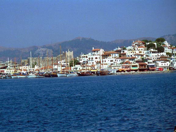
KEKOVA ISLAND
 The island that gives its name to the area is in front of the village of Kaleköy and it is accessible by boat. It is a long and narrow island measuring 7.4 km long by 500 metres wide, at its section closest to the shore. The deepest point between the island and the shore is 104 metres. The island is covered with maquis and red pine trees are found at certain places. Wild olive trees are the most abundant vegetation on the island where there is also a spring. Daily boat tours to the island start from Demre and Kaş. The origin of the city’s name is Luwian/Etruscan. It was “Khawakuwa” in the Luwian/Etruscan language and meant “land of sheep/bull”. As a matter of fact, the word “Khawa” passed, through phonetic variations, to English as “cow” and to German as “Kuh” meaning the same in these languages. Based on this information, it is assumed that a “bull/sheep” cult existed in Kekowa and that it was a shelter and sacred reproduction place for animals such as sheep, bulls and cows, which were considered sacred. Indeed, the Turkomans who came to the area in the 11th century settled on the shore across the island and preserved this tradition up to this day taking their herds to the island every year. Furthermore, the name Kekova can be meaningfully read in its old Gök=Kök Turk writing. Accordingly, Kekova means “Ingögova / mavigökova” (sky blue plain). The remains of the settlement with the same name as the island are seen on the northern side which faces the mainland. The island sank a few metres during an earthquake in antiquity. The remains of buildings seen under the sea, along the northern shore of the island, confirm this. Following the earthquake, the survivors moved to the sister cities of Simena and Teimiussa on the shore across the island. As one approaches by boat the side of the island of Kekova which faces the mainland, one sees the harbour walls, shops, sidewalks and stone steps of the Sunken City under the sea. Half-sunken houses are also seen. The remnants of the apse of a Byzantine church, built in the 5th century A.D. by Orthodox missionaries to spread Christianity in Lycia, of square plan and embellished with frescoes are seen on the shore of the Bay of Tersane. SİMENA / ÜÇAĞIZ KALEKÖY The ancient city of Simena is located on the peninsula right across the island of Kekova. Today, the small fishing village of Kale is situated among the ruins of Simena. The village of Üçağız, also accessible overland, is 20 kms to the south of the Demre – Kaş highway. Boat tours are organized to here from Demre/Çayağzı and Kaş. The fish restaurants along the shore serve to boat and yacht tourists. Kallipos is a hero among the founders of the city Simena. The name of Simena appears to be a phonetic variation of “Soamawana” which means “land of the Great Mother” in the Luwian/ Etruscan language. In one of his books, Stephanos, a Byzantine historian, refers to Simena as Somena. The history of the city dates back to around 3000 B.C. Following the Trojan War in the 12th century B.C., many Gallipolians who had sided with the Trojan King Hector, appear to have settled in Soamawana. Later, the city joined the Lycian Federation and minted its first coin in the 4th century B.C. Following the earthquake during which the city of Kekova sank into the sea, the population of Simena increased due to the influx of surviving Kekovans and the city expanded beyond the fortress. For a certain period of time, Simena was ruled by pirates. During the Roman era, Simena remained an independent city and preserved its Luwian/Etruscan culture and language. During the 9th century, triggered by an earthquake and the increasing draught, it began to decline. The most prominent structure in the area is the fortress surrounding the acropolis. The fortress is built by using the octagonal and polygonal wall techniques. The pointed arches of the towers of the fortress are an architectural feature of the Etruscan/Thracian tribe. The walls were repaired during the Byzantine era and the Middle Ages. The main entrance gate of the fortress is rectangular and it is constructed of regularly cut blocks of stone. There are cisterns within the fortress. In addition, there is a small theatre with a seating capacity of 400 and consisting of 8 rows of cavea. The orchestra has earthen floor and the structure behind the orchestra suggests that a small wooden room served as a changing room for performers. This was the smallest theatre in the Lycian region. It may be associated with the male population staying away from home for long periods of time; because they were sailors or fishermen, they did not need a large theatre. Outside the city walls, overlooking the sea, there is the stoa of the temple of Poseidon. Down towards the shore, the remains of the bathhouse of rectangular plan stand out among the other ruins. The walls of the structure were built using the polygonal wall technique and according to an inscription, it was presented to Emperor Titus. Remains of houses are seen scattered in the area. There are more than twenty house-like tombs and they are all carved into rock in the form of doors and windows. Their façades bear inscriptions in the Lycian stating facts about the deceased. Sarcophagi are carved out of rock.
 Their lids are pointed arched. The ruins of the ancient city of THEIMUSSA are found within the borders of the Üçağız village which is located immediately to the west of Simena. Among the ruins, several towers and various Lycian tombs are the most conspicuous. On the façade of one of the Lycian tombs, there is an inscription of the name of the deceased which was Kluwanimi. This proves that the site was a Luwian/Etruscan settlement and that the settlers were of Luwian origin. APERLAI – SICAK İSKELESİ The remains of the ancient city of Aperlai are seen on the southern side of the long and narrow inlet, called Sıcak, which was the second largest natural harbour in Middle Lycia. It is in the east of Bay of Kaş. The natural harbour is like a lake and it is bordered by high hills on three sides. In the Luwian/Etruscan language, the origin of the name of the city was “Aprillai” meaning “river canyon”. In the Luwian/Etruscan language, “Apr/Abra” meant “flowing water” and “ela/ila” meant “canyon”. The area is called Akar Boğazı river canyon today as it is at the tip of a long and narrow bay. The city existed in the same period as the other Luwian settlements of Kekova and Simena. It was established by the Aprillans, one of the Nordic tribes who came to Anatolia in 3000s B.C. at the site of a small preexisting Luwian harbour town. In time, it developed and expanded, and in the 6th century B.C., like the neighbouring cities, it joined the Lycian Federation. Aperlai represented also the other Aprillan cities in the Lycian Federation. It minted its first coin in the 5th century. The city, which was ruled by pirates for a while in the 1st century B.C., together with the cities of Simena, Apollonia and Isinda, possessed one vote in the Roman Lycian State Assembly, too, and collectively, they were referred to as the “Aprillans”. During the Gordion period, many structures in this ancient Lycian city were restored and new structures were built beyond the city limits, towards the coast, to enlarge the city. The city walls were restored and an Orthodox basilica was built in the Byzantine era. Also, the city was included within the borders of the bishopric. The remains of the ancient city are seen within the city walls, built to the rectangular and polygonal techniques at an altitude of 100 metres. The city walls of square form have defense towers on both sides. A stone architrave, 1.5 metres in width and 3 metres in length, rests below the semicircular frontal on the main city gate. The remains of a Byzantine church are seen in the northwestern corner of the acropolis-like fortress. Three square defense towers of square plan lean on the northern city walls. The remnants of a small Byzantine chapel are seen within the fortress. Over the years, the walls of the fortress were extended in the north-south direction towards the shore, and at the furthest end, within the harbour walls close by the sea, spaces were built every 15 metres to accommodate boats. The structures behind the 50 metre-long harbour walls were used as stores or storage areas. The necropolis of the city is in the east of the city walls and has many Lycian sarcophagi. Reliefs of flowers and other plants or inscriptions pertaining to the identity of the deceased are seen on the sarcophagi. APOLLONIA / KILINÇLI The ruins of the ancient city of Apollonia are within the borders of the village of Kılınçlı, 20 km inland, to the north of the coastal city of Aperlai in the Middle Lycian region. The origin of the word Apollon is “Apullwan” in the Luwian/Etruscan language, but, later it was pronounced like a Greek word as a result of a phonetic change. As a matter of fact, “Apa” meant “water” and “ula/ulla” meant “woodland /bushes” in the Luwian/Etruscan language. Accordingly, the name of the city meant “Apullwana/land of the god worshipped in the water hole”. According to an inscription discovered in the area, the city was founded by the Aprillans, who separated from the Aperlais of the same ethnic origin, during the Lycian period, and the citizens referred to themselves as the “Apollonian Aprillans”. Apollonia which was included in the Lycian Federation minted its first coin during the Roman era. The city developed during the Byzantine era. During this period, the city walls were restored. The theatre of the city was used as an open-air basilica. The city was looted during the Arab invasions after the 7th century and later it was attacked by the Genoese and Rhodian pirates and lost its identity. Today, the remains of the ancient city are found on top of the 90 metre-high acropolis hill and its slopes in the north of the village of Kılınçlı. The city walls of the acropolis meet the eye first. The foundation of these walls was constructed with gigantic irregular stone blocks during the Lycian period. Later, during the Roman and Byzantine eras, they were restored using rubble. The walls used to surround the acropolis hills, but, today, only the walls in the west are still standing. The assumption is that the main city gate was in the southern walls and that it was defended by towers on each side. The theatre is on a rocky hillside and only a few rows of its seats are extant. Many cisterns are also seen in the area. The openings of these cisterns resemble bell towers. The necropolis is on the northern slope of the acropolis hill and there are Lycian type sarcophagi. The most interesting tomb in the necropolis is the square Monumental Tomb which consists of a sarcophagus resting on a square stone podium on a stone pedestal and a stone-carved lid in the shape of the roof of a house, with geometrical and various plant motif carvings on its face.


No comments:
Post a Comment