Wednesday, February 14, 2007
BELDİBİ
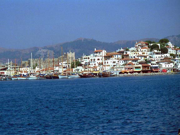
It is located at a distance of 25 km to the west of the provincial centre of Antalya. Beldibi is today included within the “Olympos Beydağları National Coastal Park” and located on a thin, long plain covering an area of four thousand acres from cape Reis to Akyarlar. To the east of the plain mountains plunge very steeply into the sea, forming cliffs of falez rock. Three families that came to the area, which was completely covered by oak forests until one hundred and fifty years ago, built up a settlement here and, subsequently, with those coming from Anamur the population increased and it became a neighbourhood under the Mukhtar (Village Elected Head) of Kemer. Sprawling on the land with an area of 30-40 acres located above the pool immediately beside Kocasu spring are the remains of the Ancient City of Marma. The area where the remains are found is densely covered with forests. Part of the remains of the ancient structure lie on a great rocky mass on the slope. Not much information is available as no excavation or research is conducted in the city. The only thing known is that they were punished, because of their plundering, by Alexander who spent the winter in Phaselis with his army in the 3rd century B.C. upon the wish of the neighboring Phaselis locals. The settlement, which became a Mukhtarlık (Village Elected Head’s Post) in 1973 and, later, a Municipality in 1994 has today become one of our foremost tourism centres thanks to its nature, citrus fruits, parades, daily picnic areas, touristic facilities and neighbouring shopping centres. GÖYNÜK is a plain in semicircular form extending from Beldibi to Kemer. Kındıl Fountain, with its fine sandy bay at the entrance of Kemer, is one of the daily resorts. The name Göynük is Gökbük in the Luwian/Etruscan language meaning “Fertile plain on the bank of a river at the joining point of the blue sky/blue”. Indeed, if Göynük plain is inspected closely it appears to have merged into the sky. It is reckoned that the ancient way, called the Old Road, to the north of the area connected Göynük to Pisidia, Termessos and Attaleia. In ancient times the valley of Göynük creek always had an important position, therefore it remained under the control of the plunderers of Pisidia. It is understood that the merchants descending from the plateau down to the shore, following the shore, went to Phaselis in the west and the plain of Attaleia in the east. The Turkoman yörüks who settled on the Cuma plain and the tablelands of Altınyaka during late 11th century revived this route to descend down to the shore and subsequently, they established a small settlement unit as a quarter subordinated to Kemer. Today there are touristic facilities to world standards along the coast of Göynük. Alternatively, hiking tours organised in the area towards the valley of the river Göynük are attractive. The narrow canyon measuring 350 m in height and 6 m in width serves tourism and is full of mysteries. KEMER/IDYROS 40 km after the provincial centre of Antalya one arrives at Kemer. The settlement lies behind the bay of the same name, on the plain again bearing the same name extending to the Taurus mountains. 251 species of flowers are grown in the area. According to mythological accounts, Abıhayat/Bengisu, that is, spring of immortality water, should be somewhere in the sea section of the cape into which Ağva creek at the south-western end of the Kemer bay flows. The area, called Abaawa, that is, “Sacred Water Spring” by the Luwians was subsequently named as “Ağva” through the same phonetic saying by the Turkoman yörüks who later came to the area. We know that the history of the area goes back to thousands of years before Christ. According to the Luwian myth, the bull-headed chief god and symbol of masculinity Adra/Toro/Toros, while watching the dolphins swim in the sea, likes it very much and he himself also dives into the sea by jumping over the Mount Tahtalı. He swims after the fish with beautiful colours that he sees and arrives at the shore where Mount Çalış steeply plunges into the sea. Adra, who here finds Abıhayat/Bengisu, that is, the spring of sacred immortality water, drinks of the water and becomes everlastingly immortal. Luwians, based on this myth, build the Sacred Temple “Adrawana” meaning the country of Adra, male of the mother goddess, near the water of immortality in the Bay of Kemer. Deeply impressed by the legend of the sacred temple and Adra/Toro/Toros the god, Alexander the Great also pronounces the name of the temple as “Idyros” with its phonetics in the Hellenic language. Furthermore, the Macedonian historians hastily adapt a version of this myth to Alexander the Great. According to this, his chef wishes to cook fried fish for Alexander; the fish suddenly become alive and escape by swimming. The cook also jumps off into the sea after the fish and, reaching Abıhayat/Bengisu, that is, the spring of sacred immortality water, he becomes immortal. The Taurus myth is preserved in every epoch with its characteristics and sacredness and adapted to current circumstances. From this, we understand that the ancient city owned a large, sacred Adra temple as renowned not only in Anatolia but in all of the Mediterranean countries. Upon the very frequent overflowing of the Creek Ağva which was joined by the floodwater from the Taurus mountains the Temple Adra subsequently went into ruins and remained under alluvial earth. The plains of Kemer and Ağva where the temple was located, which turned completely into a swamp and were abandoned to mosquitoes in time, were improved with the name Eskiköy by the Teke Yörüks towards the end of the 1800s. However, in the place of the village, which was ruined again because of the flood from the mountains, a marshy lake was formed. The area was rebuilt by the yörüks coming from the Taurus tablelands between 1916-1917. In order to protect the village a protection arch was woven in the form of a stone wall on the slopes of the Mount Kızılcık. This wall was compared to an arch and the village established later became associated with the name Kemer (Arch). In 1992 it became a municipality. The locals of Kemer eventually improved the swamps on the plains of Kemer and Ağva and grew the famous Kemer oranges. Subsequently, the tourism potential developed in the area at a great pace. The Yörük Park daytime facilities and restaurants, with the ethnographic characteristics of yörük lifestyle, on the Kemer Ayışığı Bay are well worth a visit. Kemer, which was replanned with all its infrastructures in the subject of urbanism has become one of the foremost tourism centres with its touristic facilities renowned throughout the world. Beycik Tableland in Kemer, thanks to its low level of humidity and cool air and the facilities and villas built among its natural beauties, has turned into a mountain resort. “Anatolian Rally” has been organised as a sportive safari activity on the tablelands of Kemer since 2000 and recorded in the World Rally Championship Calendar under the name “Rally of Turkey”. Among the natural beauties of the Taurus Mountains there are 18 special lap track courses on the routes of Ovacık-Konyaaltı-Kemer-Phaselis-Olympos-Myra-Simena-Aspendos-Perge covering a total of 1300 km. The rally organised over three stages has a special lap of 380 km on the ground track course. ”Altınlar Tourism Carnival” is organised in Kemer and “Yeşilyayla Oil Wrestling Matches” on Söğütcuması, Gödene and Belen, of the tablelands on the Mount Beydağları, every year. On the same tableland jeep-safari tours are organised for tourists. Furthermore, touristic hiking tours are carried out among the unique natural beauties on the routes of Kemer –Kuzdere –Karataşlar –Sapandere –Aslanbucak. Kemer-Ağva Cape provides excellent means for underwater diving. In brief, Kemer, which was set up by the spring of immortality, today opens the doors of its touristic facilities built to high standards for tourists visiting from all around the world, offers means of shopping with perfect friendship and shows of affection and grants immortal memories and beauties to them through magnificent excursions into nature. ÇAMYUVA is a narrow plain to the west of the Kemer settlement irrigated by Ağva Creek. Today it is a tourism centre with all its magnificent touristic facilities. The most notable aspect of the natural port of Ağva is that it was the place where the battleships Paris II and Alexandra were sunk during the Ist World War in 1917. KİRİŞ is a natural bay of the same name where the blue sea meets the pine forests and enjoys touristic accommodation facilities renowned worldwide. There are parades through the forest and along the coast between Kiriş – Çamyuva and Kemer.
Subscribe to:
Post Comments (Atom)


No comments:
Post a Comment