Gökova Gulf Shores
The sea tourism in Marmaris is not limited to just the city. There are bays, beaches and small islands all around the Peninsula. Most of those bays can be reached both by land and sea. Let’s take a tour around the Gökova Gulf coast.
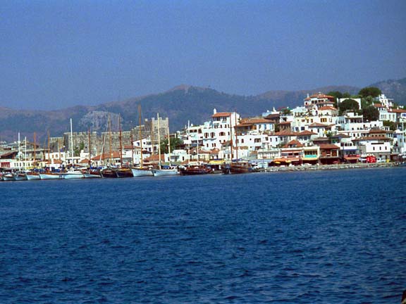
Gökova Gulf
It is a well-known fact that the Gökova Gulf which comprises a part of Bodrum-Milas-Marmaris and Datça coasts is the most beautiful gulf in Turkey. The sea and the pine trees integrate well with the bays sometimes running amongst the pine trees like a river. The ropes of boats can be fastened to the pine trees on the shore. There are multiple roads to the Gökova Gulf from Marmaris.
Çamlık Pier
The road turning left on the 12th km along the Marmaris-Muğla road leads to Gökova Bay and 6km further on you arrive at the Çamlık bay. It is an area abundant with pine trees. It is a stopping point for boats going to Sedir Island. There is a buffet, an open cafe in the Bay’s square and a restaurant among the trees. The name of the beautiful bay 3km away, just opposite Sedir Island is Çamlı. The bay after Çamlık is called Bead Bay. These are ideal places to swim and rest under the shade of the pine trees. There are some small establishments for food and drinks as well.
Sedir (Kedrai) Island and the Cleopatra Legend.
Left again from the 12 th km of Marmaris-Muğla road and the road reaching to Gökova shores will take you to Çamlık Pier 6kms further. Sedir Island can be visited by boats traveling from Çamlık Bay.
Sedir Island is well known for the ancient city Kedrai and Cleopatra Beach. Kedrai was known as Karia city before it was connected to Rhodes.
Kedrai means “cedars” (cedar tree). Kedrai, being the most important settlement centre of Rhodes opposite side (Karşıyaka), was surrounded by walls. While the tower and the walls can be seen from the shore, only the foundation of the Apollo Temple in Doric style has survived today. There is a theatre facing north which is in good condition beside the agora , and various remains of the city necropolis.
Cleopatra and Antonius
In a lot of places on Anatolian shores, there are legends and names related to Cleopatra. It is known that the queen and her lover, Roman commander Antonius had visited the Anatolian shores. But it is unknown if they visited this Island. The Island has a legend ascribed to its golden yellow sands. It is said that they were brought from Egypt by ships for the meeting of Cleopatra and Antonius on the Island.
Actually this sand is formed from limestone droplets and can only be seen on Sedir and Crete Islands in the Aegean and Mediterranean. Sand particles which look like small beads ignite when exposed to fire. Cleopatra Beach still attracts attention with its golden colored sands and its sea, reflecting various tones of blue.
Karacasöğüt: the waterfall, cave and antique settlements.
There is a junction at the 11th km of the Marmaris-Muğla road. The diverting road at the junction leads to unique Gökova shores. The Karacasöğüt Port is one of the not to be missed stopping points of the blue boat trips.
Going to Okluk Bay for Söğüt Waterfall and Karacain Cave.
The waterfall drops from 25 meters. It has a natural pool below. Do not get caught by surprise if the water draws back during hot summer months. The Cave has two parts. Somalıkaya Düdeni and Suçıktı Cave. One of the main entries to the caves is here. Only dinghies can move in the galleries of the cave. The cave is 421m long and 15.5m wide. While accommodating two lakes, only 342 meters of the cave can be seen. Amateurs can go into the cave only with guides and are not able to go further than 10m unaccompanied. Only 1km of the Suçıktı Cave has been explored. Works to open the cave to visitors are in progress.
There are remains of the Ancient City Euthena close to Karacasöğüt. The City Necropolis, whose walls remain, rock graves and cisterns can also be seen, as you get closer to the hill. There are remains of the antique period temple at the top of the hill.
Remains of the ancient City Amnistos are located on a promontory close to the village. Only the city wall remains from the antique city and the old port wall exists today
Other bays and ports
It is possible to get to other bays by going alongside the Gulf. Although it seems that visiting those bays by boat is the best way, a land trip gives and offers a different perspective. The bays that can be reached are Okluk, English Port, Löngöz, Seven Islands, Gücük Port and Bördübet Bay. There are other large and small bays amongst these
There is an abundance of simple but high quality restaurants offering fresh fish, seafood and appetizers made from different herbs found in the bays.
Amazon Camping at Bördübet Bay is the last stop.Turunç
A district in Marmaris. It is one of the 5 municipalities in Marmaris. Turunç is 20km away by land and 15 miles away by sea. It can be reached in half an hour using the winding asphalt road crossing the forest in İçmeler.
Turunç is surrounded by high hills planted with pine trees. Coolness falls on the shores from the hills. The sun is always bright but not suffocatingly hot. Pomegranates, mulberries, plums and of course Seville oranges…Geraniums, oleanders and begonvilla are everywhere.
Turunç is one of the more popular stopping points for blue cruises. In the evening, songs are heard from restaurants on the shore and boats anchored in the bay.
Those who wish to take nature walks, canoe, canyon, mountain climb, and sail, wind surf or attend jeep-safari tours can find convenient areas to do so. The most adventurous scuba dives can also be made here.
There are operators providing water sports in the bay.
Kumlubük
Kumlubük is located a little bit ahead of Turunç and famous for it’s restaurants beside the beach. You can spare either a morning or an evening for a walk to the ancient city Amos. Amos can be reached in one hour from Turunç and half an hour from Kumlubük by walking. Although Amos was one of the most important cities in ancient times, not much remains today. However, remains of the city walls and the theatre can be seen. The Necropolis is spread towards the slope of the bay